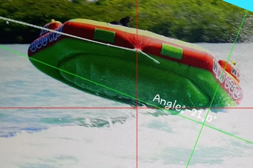
Dual-Axis Calibration
Engineered for Precision Surveying and Architectural Insight
Utilize two distinct axes for comprehensive spatial mapping. This allows precise determination of angles on complex vertical structures.
- Beyond the Bubble Level
Sensor-Driven Calculation
Sensor-Driven Calculation
The application processes raw device sensor data to calculate accurate angles, moving beyond simple visual estimation. This ensures reliable readings even in challenging environments.

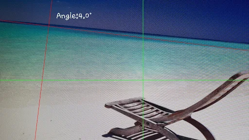
Contextual Capture Mode
Contextual Capture Mode
Integrate measurement directly into your workflow by capturing photographs alongside the angle data. This creates an immutable record linking geometry to physical context.